
2019, ISBN: 1566953790
[EAN: 9781566953795], Neubuch, [PU: National Geographic Maps, United States], Language: English. Brand new Book. - Waterproof - Tear-Resistant - Topographic MapExpertly researched and cre… More...
| AbeBooks.de The Book Depository, London, United Kingdom [54837791] [Rating: 5 (von 5)] NEW BOOK. Shipping costs: EUR 0.55 Details... |

ISBN: 9781566953795
• Waterproof • Tear-Resistant • Topographic MapExpertly researched and created in cooperation with the U.S. Forest Service and others, National Geographic's Trails Illustra… More...
| BarnesandNoble.com new in stock. Shipping costs:zzgl. Versandkosten., plus shipping costs Details... |

ISBN: 9781566953795
National Geographic's Trails Illustrated Maps are the most detailed and up-to-date topographic recreation maps available for US National Parks, National Forests and other popular outdoor … More...
| wordery.com Nr. 9781566953795. Shipping costs:, , zzgl. Versandkosten., plus shipping costs Details... |

Black Hills - Northeast, South Dakota Trails Illustrated Map #751 (National Geographic Maps: Trails Illustrated) - used book
2001, ISBN: 9781566953795
Natl Geographic Society Maps, 2001-01-01. 2. Map. Used:Good., Natl Geographic Society Maps, 2001-01-01
| Biblio.co.uk |
2001, ISBN: 9781566953795
Natl Geographic Society Maps, 2001-01-01. Map. Good., Natl Geographic Society Maps, 2001-01-01
| Biblio.co.uk |

2019, ISBN: 1566953790
[EAN: 9781566953795], Neubuch, [PU: National Geographic Maps, United States], Language: English. Brand new Book. - Waterproof - Tear-Resistant - Topographic MapExpertly researched and cre… More...

ISBN: 9781566953795
• Waterproof • Tear-Resistant • Topographic MapExpertly researched and created in cooperation with the U.S. Forest Service and others, National Geographic's Trails Illustra… More...

ISBN: 9781566953795
National Geographic's Trails Illustrated Maps are the most detailed and up-to-date topographic recreation maps available for US National Parks, National Forests and other popular outdoor … More...
Black Hills - Northeast, South Dakota Trails Illustrated Map #751 (National Geographic Maps: Trails Illustrated) - used book
2001, ISBN: 9781566953795
Natl Geographic Society Maps, 2001-01-01. 2. Map. Used:Good., Natl Geographic Society Maps, 2001-01-01
2001, ISBN: 9781566953795
Natl Geographic Society Maps, 2001-01-01. Map. Good., Natl Geographic Society Maps, 2001-01-01
Bibliographic data of the best matching book

• Waterproof • Tear-Resistant • Topographic Map
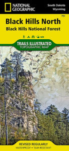
Expertly researched and created in cooperation with the U.S. Forest Service and others, National Geographic's Trails Illustrated map of Black Hills North is an essential travel companion for outdoor enthusiasts exploring this area. The map provides unmatched detail of the northern region of Black Hills National Forest including popular recreation spots Roughlock Falls, Pactola Reservoir, Spearfish Canyon Scenic Byway and Deerfield and Sheridan Lakes as well as Fort Meade Recreation Area.
Trailheads will guide you to motorized and non-motorized trails, many which are marked with mileage indicators, including the very popular Eagle Cliffs and Beaver Creek Trail Systems. The Centennial and George S. Mickelson Trails are both highlighted and trails that are part of the National Recreation Trail system are duly noted. To aid in your navigation of the area, the map has shaded relief, water features, contour lines and elevations; hundreds of numbered forest service roads, OHV routes and driveable trails; and shaded areas of private property. Recreation features include areas for camping, picnics, fishing, skiing and swimming. Also provided are background information about the area, descriptions of popular recreation spots, safety tips and essential contact information.
Every Trails Illustrated map is printed on "Backcountry Tough" waterproof, tear-resistant paper. A full UTM grid is printed on the map to aid with GPS navigation.
Other features found on this map include: Black Hills, Black Hills National Forest, Crooks Tower, Crows Nest Peak, Custer Peak, Elkhorn Peak, Flag Mountain, Medicine Mountain, Nipple Butte, Norris Peak, Terry Peak, White Tail Peak.
Map Scale = 1:70,000Sheet Size = 25.5" x 37.75"Folded Size = 4.25" x 9.25"Details of the book - Black Hills North: Trails Illustrated Map National Geographic Author
EAN (ISBN-13): 9781566953795
ISBN (ISBN-10): 1566953790
Paperback
Publishing year: 2010
Publisher: National Geographic Maps Core >9
2 Pages
Language: eng/Englisch
Book in our database since 2011-05-08T21:24:56-04:00 (New York)
Detail page last modified on 2020-08-24T08:14:51-04:00 (New York)
ISBN/EAN: 9781566953795
ISBN - alternate spelling:
1-56695-379-0, 978-1-56695-379-5
Alternate spelling and related search-keywords:
Book author: national geographic maps
Book title: black hills, 751, the black hill, national north, south dakota, national geographic, dakota map star, black maps
Information from Publisher
Title: Black Hills, Northeast - National Geographic Trails Illustrated National Parks
Publisher: National Geographic Maps
Language: English
9,99 € (DE)
10,30 € (AT)
Not available (reason unspecified)
CB; GEF; Karten, Globen / Reisen/Karten, Stadtpläne, Atlanten/Nordamerika, Mittelamerika; Landkarten und Atlanten; Nordamerika (USA und Kanada)
More/other books that might be very similar to this book
Latest similar book:
0749717017030 Manti-La Sal National Forest Map: Trails Illustrated Other Rec. Areas (National Geographic Trails Illustrated Map) (National Geographic Maps)
< to archive...