1
Cumming, William P (1900-1989):The Southeast in Early Maps - hardcover
2018, ISBN: 9780807823712
2012-01-10. Good. Ships with Tracking Number! INTERNATIONAL WORLDWIDE Shipping available. May not contain Access Codes or Supplements. May be ex-library. Shipping & Handling b… More...
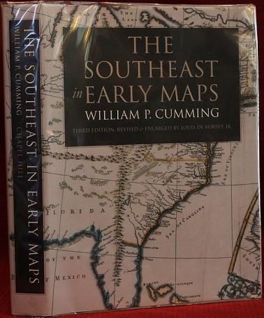
2012-01-10. Good. Ships with Tracking Number! INTERNATIONAL WORLDWIDE Shipping available. May not contain Access Codes or Supplements. May be ex-library. Shipping & Handling by region. Buy with confidence, excellent customer service!, 2012-01-10, 20120222. Good. Ships with Tracking Number! INTERNATIONAL WORLDWIDE Shipping available. May not contain Access Codes or Supplements. May be ex-library. Shipping & Handling by region. Buy with confidence, excellent customer service!, 20120222, 2012-02-22. New. Ships with Tracking Number! INTERNATIONAL WORLDWIDE Shipping available. Buy with confidence, excellent customer service!, 2012-02-22, 20120222. Good. Ships with Tracking Number! INTERNATIONAL WORLDWIDE Shipping available. May not contain Access Codes or Supplements. May be ex-library. Shipping & Handling by region. Buy with confidence, excellent customer service!, 20120222, 2018. SUPER DELUXE EDITION. New. Antique look with Golden Leaf Printing and embossing with round Spine completely handmade binding(extra customization on request like Color Leather, Colored book, special gold leaf printing etc.) Reprinted in 2018 with the help of original edition published long back [1508]. This book is printed in black & white, sewing binding for longer life, Printed on high quality Paper, re-sized as per Current standards, professionally processed without changing its contents. As these are old books, we processed each page manually and make them readable but in some cases some pages which are blur or missing or black spots. If it is multi volume set, then it is only single volume. We expect that you will understand our compulsion in these books. We found this book important for the readers who want to know more about our old treasure in old look so we brought it back to the shelves. Hope you will like it and give your comments and suggestions. Lang: - lat, Pages 652. EXTRA 10 DAYS APART FROM THE NORMAL SHIPPING PERIOD WILL BE REQUIRED. (Normal Hardbound Edition is also available on request.), 2018, xvi+362 pages with figures, illustrations, plates (some in color), bibliography and index. Folio (12 1/2" x 9 1/4") bound in original publisher's brown cloth with black label in silver lettering to spine and cover in original pictorial jacket. Revised and enlarged by Louis de Vorsey, Jr. Third edition.William P. Cummings's book The Southeast in Early Maps contains one of the most thorough and comprehensive bibliographies of early maps of the Southeastern United States. First published in 1958, is classic study of the mapping of the Southeast before the American Revolution. By analyzing printed and manuscript maps of the area in the light of other contemporary primary documents, the book traces the expansion of geographical knowledge about the Southeast over the course of its discovery and colonization. It is an indispensable resource for the study of the history of maps of North Carolina. The bibliography contains an extensive list of Colonial era maps of the Southeast, from Waldseemüller's 1507 map, "Universalis Cosmographia," (the first world map to use the name "America") through maps of Southeastern states published in 1775. Many of the maps digitized for the North Carolina Maps project are included in this bibliography.Condition:A fine copy in like jacket., University of North Carolina Press, 1998<
- Shipping costs:Versandkostenfrei. (EUR 43.56) Books Express, Books Express, Books Express, Books Express, Gyan Books, The Book Collector
2
Cumming, William P (1900-1989):
The Southeast in Early Maps
- used book1998, ISBN: 9780807823712
13 grandes hojas de 70x50. En la primera se reproduce la carta reducida íntegramente y, las otras doce son reproducciones parciales a tamaño real que son el resultado de div… More...
13 grandes hojas de 70x50. En la primera se reproduce la carta reducida íntegramente y, las otras doce son reproducciones parciales a tamaño real que son el resultado de dividir el mapa en 12 partes con lo que se consigue una reproducción a mayor tamaño y con mayor precisión en los detalles. Al reverso de la primera carta viene un texto explicativo del origen y las características constructivas de la misma. [Autor: Martin Waldseemüller. Lugar de publicación: Saint-Dié. Estrasburgo, 1516]. Imnasa. Madrid, 1959., 0, 13 grandes hojas de 70x50. En la primera se reproduce el mapa íntegramente a tamaño reducido y, las otras doce son reproducciones parciales que son el resultado de dividir el mapa en 12 partes con lo que se consigue una reproducción a tamaño real y con mayor precisión en los detalles. Al reverso del primer mapa viene un texto explicativo del origen y las características constructivas del mismo. [Autor: Martin Waldseemüller. Lugar de publicación: Saint-Dié. Estrasburgo, 1507. Tanto el autor como el lugar de estampación son deducidos]. Imnasa. Madrid, 1959., 0, xvi+362 pages with figures, illustrations, plates (some in color), bibliography and index. Folio (12 1/2" x 9 1/4") bound in original publisher's brown cloth with black label in silver lettering to spine and cover in original pictorial jacket. Revised and enlarged by Louis de Vorsey, Jr. Third edition.William P. Cummings's book The Southeast in Early Maps contains one of the most thorough and comprehensive bibliographies of early maps of the Southeastern United States. First published in 1958, is classic study of the mapping of the Southeast before the American Revolution. By analyzing printed and manuscript maps of the area in the light of other contemporary primary documents, the book traces the expansion of geographical knowledge about the Southeast over the course of its discovery and colonization. It is an indispensable resource for the study of the history of maps of North Carolina. The bibliography contains an extensive list of Colonial era maps of the Southeast, from Waldseemüller's 1507 map, "Universalis Cosmographia," (the first world map to use the name "America") through maps of Southeastern states published in 1775. Many of the maps digitized for the North Carolina Maps project are included in this bibliography.Condition:A fine copy in like jacket., University of North Carolina Press, 1998, 5<
ESP, E.. - Shipping costs: EUR 19.03 LIBRERÍA ANTICUARIA GALGO, LIBRERÍA ANTICUARIA GALGO, The Book Collector ABAA, ILAB
3
Cumming, William P (1900-1989):The Southeast in Early Maps
- used book 1998
20100819. Good. Ships with Tracking Number! INTERNATIONAL WORLDWIDE Shipping available. May not contain Access Codes or Supplements. May be ex-library. Shipping & Handling by … More...
20100819. Good. Ships with Tracking Number! INTERNATIONAL WORLDWIDE Shipping available. May not contain Access Codes or Supplements. May be ex-library. Shipping & Handling by region. Buy with confidence, excellent customer service!, 20100819, xvi+362 pages with figures, illustrations, plates (some in color), bibliography and index. Folio (12 1/2" x 9 1/4") bound in original publisher's brown cloth with black label in silver lettering to spine and cover in original pictorial jacket. Revised and enlarged by Louis de Vorsey, Jr. Third edition.William P. Cummings's book The Southeast in Early Maps contains one of the most thorough and comprehensive bibliographies of early maps of the Southeastern United States. First published in 1958, is classic study of the mapping of the Southeast before the American Revolution. By analyzing printed and manuscript maps of the area in the light of other contemporary primary documents, the book traces the expansion of geographical knowledge about the Southeast over the course of its discovery and colonization. It is an indispensable resource for the study of the history of maps of North Carolina. The bibliography contains an extensive list of Colonial era maps of the Southeast, from Waldseemüller's 1507 map, "Universalis Cosmographia," (the first world map to use the name "America") through maps of Southeastern states published in 1775. Many of the maps digitized for the North Carolina Maps project are included in this bibliography.Condition:A fine copy in like jacket., University of North Carolina Press, 1998<
- Shipping costs: EUR 42.55 Books Express, The Book Collector
4
Cumming, William P (1900-1989):The Southeast in Early Maps
- hardcover 1998, ISBN: 0807823716
[EAN: 9780807823712], Gebraucht, guter Zustand, [PU: University of North Carolina Press, Chapel Hill and London], MAPS, FLORIDA, CAROLINAS, Jacket, xvi+362 pages with figures, illustratio… More...
[EAN: 9780807823712], Gebraucht, guter Zustand, [PU: University of North Carolina Press, Chapel Hill and London], MAPS, FLORIDA, CAROLINAS, Jacket, xvi+362 pages with figures, illustrations, plates (some in color), bibliography and index. Folio (12 1/2" x 9 1/4") bound in original publisher's brown cloth with black label in silver lettering to spine and cover in original pictorial jacket. Revised and enlarged by Louis de Vorsey, Jr. Third edition. William P. Cummings's book The Southeast in Early Maps contains one of the most thorough and comprehensive bibliographies of early maps of the Southeastern United States. First published in 1958, is classic study of the mapping of the Southeast before the American Revolution. By analyzing printed and manuscript maps of the area in the light of other contemporary primary documents, the book traces the expansion of geographical knowledge about the Southeast over the course of its discovery and colonization. It is an indispensable resource for the study of the history of maps of North Carolina. The bibliography contains an extensive list of Colonial era maps of the Southeast, from Waldseemüller's 1507 map, "Universalis Cosmographia," (the first world map to use the name "America") through maps of Southeastern states published in 1775. Many of the maps digitized for the North Carolina Maps project are included in this bibliography. Condition: A fine copy in like jacket., Books<
NOT NEW BOOK. Shipping costs: EUR 50.12 The Book Collector, Inc. ABAA, ILAB, Fort Worth, TX, U.S.A. [91976] [Rating: 5 (von 5)]
5
Cumming, William P (1900-1989):The Southeast in Early Maps
- used book 1998, ISBN: 9780807823712
xvi+362 pages with figures, illustrations, plates (some in color), bibliography and index. Folio (12 1/2" x 9 1/4") bound in original publisher's brown cloth with black label in silver le… More...
xvi+362 pages with figures, illustrations, plates (some in color), bibliography and index. Folio (12 1/2" x 9 1/4") bound in original publisher's brown cloth with black label in silver lettering to spine and cover in original pictorial jacket. Revised and enlarged by Louis de Vorsey, Jr. Third edition.William P. Cummings's book The Southeast in Early Maps contains one of the most thorough and comprehensive bibliographies of early maps of the Southeastern United States. First published in 1958, is classic study of the mapping of the Southeast before the American Revolution. By analyzing printed and manuscript maps of the area in the light of other contemporary primary documents, the book traces the expansion of geographical knowledge about the Southeast over the course of its discovery and colonization. It is an indispensable resource for the study of the history of maps of North Carolina. The bibliography contains an extensive list of Colonial era maps of the Southeast, from Waldseemüller's 1507 map, "Universalis Cosmographia," (the first world map to use the name "America") through maps of Southeastern states published in 1775. Many of the maps digitized for the North Carolina Maps project are included in this bibliography.Condition:A fine copy in like jacket., University of North Carolina Press, 1998, 5<
Shipping costs: EUR 19.15 The Book Collector ABAA, ILAB


