1

Findlay, Alexander G.:
Classical Atlas to Illustrate Ancient Geography - hardcover
1854, ISBN: 6e3eef45a4485bc512184fbfc0f5818d
Gebraucht, guter Zustand, [SC: 37.21], [PU: William Tegg & Co., London], ANTIQUARIAN ATLAS ANCIENT GEOGRAPHY CARTOGRAPHY ORBIS VETERIBUS NOTUS; ROMA; ITALIA MERIDIONALIS; ATHENAE; PELOPON… More...
Gebraucht, guter Zustand, [SC: 37.21], [PU: William Tegg & Co., London], ANTIQUARIAN ATLAS ANCIENT GEOGRAPHY CARTOGRAPHY ORBIS VETERIBUS NOTUS; ROMA; ITALIA MERIDIONALIS; ATHENAE; PELOPONNESUS ET ATTICA; GRAECIA SEPTENTRIONALIS; INSULEAE MARIS AEG AEI; MACEDONIA, THRACIA, ILLYRIA, MOESIA, DACIA; BRITANNIA; BRITANNICAE; GALLIA; GERMANIA; VINDELICIA, NORICUM, RHAETIA, PANNONIA, ILLYRICUM; HISPANIA; AFRICA AEGYPTUS; ASIA MINOR; PALAESTINA; SYRIA; ARMENIA, MESOPOTAMIA, ASSYRIA, BABYLONIA; ARABIA; IMPERIUM PERSICUM; INDIAE, "Comprised in twenty-six maps showing the various divisions of the world as known to the ancients composed from the most authentic sources with an index of the ancient and modern names." - from title page. Includes the following maps: Orbis Veteribus Notus; Roma; Italia Meridionalis; Athenae; Peloponnesus et Attica; Graecia Septentrionalis; Insuleae Maris Aeg Aei; Macedonia, Thracia, Illyria, Moesia, et Dacia; Britannia; Insuleae Britannicae; Gallia; Germania; Vindelicia, Noricum, Rhaetia, Pannonia, et Illyricum; Hispania; Africa Septentrionalis; Aegyptus; Asia Minor; Palaestina; Syria; Armenia, Mesopotamia, Assyria, et Babylonia; Arabia; Imperium Persicum; Indiae. Fold-out map entitled 'Central Italy with the Adjacent Countries from the Peutingerian Tables, constructed about A.D. 393'. Extensive 44-page index of place names. Hand done colour outlines to most maps. Average external wear. 1.5" opening to upper corner of front free endpaper. Toning to endpapers. Gilt titling clearly legible upon backstrip. Binding sound. A quality copy of this wonderful reference., Books<
CDN - NOT NEW BOOK. Shipping costs: EUR 37.21 RareNonFiction, IOBA, Ladysmith, BC, Canada [593933] [Rating: 5 (von 5)]
2
Findlay, Alexander G.:
Classical Atlas to Illustrate Ancient Geography - hardcover1854, ISBN: 6e3eef45a4485bc512184fbfc0f5818d
Gebraucht, guter Zustand, [SC: 23.97], [PU: William Tegg & Co., London], ANTIQUARIAN ATLAS ANCIENT GEOGRAPHY CARTOGRAPHY ORBIS VETERIBUS NOTUS; ROMA; ITALIA MERIDIONALIS; ATHENAE; PELOPON… More...
Gebraucht, guter Zustand, [SC: 23.97], [PU: William Tegg & Co., London], ANTIQUARIAN ATLAS ANCIENT GEOGRAPHY CARTOGRAPHY ORBIS VETERIBUS NOTUS; ROMA; ITALIA MERIDIONALIS; ATHENAE; PELOPONNESUS ET ATTICA; GRAECIA SEPTENTRIONALIS; INSULEAE MARIS AEG AEI; MACEDONIA, THRACIA, ILLYRIA, MOESIA, DACIA; BRITANNIA; BRITANNICAE; GALLIA; GERMANIA; VINDELICIA, NORICUM, RHAETIA, PANNONIA, ILLYRICUM; HISPANIA; AFRICA AEGYPTUS; ASIA MINOR; PALAESTINA; SYRIA; ARMENIA, MESOPOTAMIA, ASSYRIA, BABYLONIA; ARABIA; IMPERIUM PERSICUM; INDIAE, "Comprised in twenty-six maps showing the various divisions of the world as known to the ancients composed from the most authentic sources with an index of the ancient and modern names." - from title page. Includes the following maps: Orbis Veteribus Notus; Roma; Italia Meridionalis; Athenae; Peloponnesus et Attica; Graecia Septentrionalis; Insuleae Maris Aeg Aei; Macedonia, Thracia, Illyria, Moesia, et Dacia; Britannia; Insuleae Britannicae; Gallia; Germania; Vindelicia, Noricum, Rhaetia, Pannonia, et Illyricum; Hispania; Africa Septentrionalis; Aegyptus; Asia Minor; Palaestina; Syria; Armenia, Mesopotamia, Assyria, et Babylonia; Arabia; Imperium Persicum; Indiae. Fold-out map entitled 'Central Italy with the Adjacent Countries from the Peutingerian Tables, constructed about A.D. 393'. Extensive 44-page index of place names. Hand done colour outlines to most maps. Average external wear. 1.5" opening to upper corner of front free endpaper. Toning to endpapers. Gilt titling clearly legible upon backstrip. Binding sound. A quality copy of this wonderful reference., Books<
CDN - NOT NEW BOOK. Shipping costs: EUR 23.97 RareNonFiction, IOBA, Ladysmith, BC, Canada [593933] [Rating: 5 (von 5)]
3
Findlay, Alexander G.:
Classical Atlas to Illustrate Ancient Geography - hardcover
1854
ISBN: 6e3eef45a4485bc512184fbfc0f5818d
Gebraucht, guter Zustand, [SC: 22.58], [PU: William Tegg & Co., London], ANTIQUARIAN ATLAS ANCIENT GEOGRAPHY CARTOGRAPHY ORBIS VETERIBUS NOTUS; ROMA; ITALIA MERIDIONALIS; ATHENAE; PELOPON… More...
Gebraucht, guter Zustand, [SC: 22.58], [PU: William Tegg & Co., London], ANTIQUARIAN ATLAS ANCIENT GEOGRAPHY CARTOGRAPHY ORBIS VETERIBUS NOTUS; ROMA; ITALIA MERIDIONALIS; ATHENAE; PELOPONNESUS ET ATTICA; GRAECIA SEPTENTRIONALIS; INSULEAE MARIS AEG AEI; MACEDONIA, THRACIA, ILLYRIA, MOESIA, DACIA; BRITANNIA; BRITANNICAE; GALLIA; GERMANIA; VINDELICIA, NORICUM, RHAETIA, PANNONIA, ILLYRICUM; HISPANIA; AFRICA AEGYPTUS; ASIA MINOR; PALAESTINA; SYRIA; ARMENIA, MESOPOTAMIA, ASSYRIA, BABYLONIA; ARABIA; IMPERIUM PERSICUM; INDIAE, "Comprised in twenty-six maps showing the various divisions of the world as known to the ancients composed from the most authentic sources with an index of the ancient and modern names." - from title page. Includes the following maps: Orbis Veteribus Notus; Roma; Italia Meridionalis; Athenae; Peloponnesus et Attica; Graecia Septentrionalis; Insuleae Maris Aeg Aei; Macedonia, Thracia, Illyria, Moesia, et Dacia; Britannia; Insuleae Britannicae; Gallia; Germania; Vindelicia, Noricum, Rhaetia, Pannonia, et Illyricum; Hispania; Africa Septentrionalis; Aegyptus; Asia Minor; Palaestina; Syria; Armenia, Mesopotamia, Assyria, et Babylonia; Arabia; Imperium Persicum; Indiae. Fold-out map entitled 'Central Italy with the Adjacent Countries from the Peutingerian Tables, constructed about A.D. 393'. Extensive 44-page index of place names. Hand done colour outlines to most maps. Average external wear. 1.5" opening to upper corner of front free endpaper. Toning to endpapers. Gilt titling clearly legible upon backstrip. Binding sound. A quality copy of this wonderful reference., Books<
CDN - NOT NEW BOOK. Shipping costs: EUR 22.58 RareNonFiction, IOBA, Ladysmith, BC, Canada [593933] [Rating: 5 (von 5)]
4
Findlay, Alexander G.:
Classical Atlas to Illustrate Ancient Geography - hardcover
1854, ISBN: 6e3eef45a4485bc512184fbfc0f5818d
Gebraucht, guter Zustand, [SC: 22.7], [PU: William Tegg & Co., London], ANTIQUARIAN ATLAS ANCIENT GEOGRAPHY CARTOGRAPHY ORBIS VETERIBUS NOTUS; ROMA; ITALIA MERIDIONALIS; ATHENAE; PELOPONN… More...
Gebraucht, guter Zustand, [SC: 22.7], [PU: William Tegg & Co., London], ANTIQUARIAN ATLAS ANCIENT GEOGRAPHY CARTOGRAPHY ORBIS VETERIBUS NOTUS; ROMA; ITALIA MERIDIONALIS; ATHENAE; PELOPONNESUS ET ATTICA; GRAECIA SEPTENTRIONALIS; INSULEAE MARIS AEG AEI; MACEDONIA, THRACIA, ILLYRIA, MOESIA, DACIA; BRITANNIA; BRITANNICAE; GALLIA; GERMANIA; VINDELICIA, NORICUM, RHAETIA, PANNONIA, ILLYRICUM; HISPANIA; AFRICA AEGYPTUS; ASIA MINOR; PALAESTINA; SYRIA; ARMENIA, MESOPOTAMIA, ASSYRIA, BABYLONIA; ARABIA; IMPERIUM PERSICUM; INDIAE, "Comprised in twenty-six maps showing the various divisions of the world as known to the ancients composed from the most authentic sources with an index of the ancient and modern names." - from title page. Includes the following maps: Orbis Veteribus Notus; Roma; Italia Meridionalis; Athenae; Peloponnesus et Attica; Graecia Septentrionalis; Insuleae Maris Aeg Aei; Macedonia, Thracia, Illyria, Moesia, et Dacia; Britannia; Insuleae Britannicae; Gallia; Germania; Vindelicia, Noricum, Rhaetia, Pannonia, et Illyricum; Hispania; Africa Septentrionalis; Aegyptus; Asia Minor; Palaestina; Syria; Armenia, Mesopotamia, Assyria, et Babylonia; Arabia; Imperium Persicum; Indiae. Fold-out map entitled 'Central Italy with the Adjacent Countries from the Peutingerian Tables, constructed about A.D. 393'. Extensive 44-page index of place names. Hand done colour outlines to most maps. Average external wear. 1.5" opening to upper corner of front free endpaper. Toning to endpapers. Gilt titling clearly legible upon backstrip. Binding sound. A quality copy of this wonderful reference., Books<
CDN - NOT NEW BOOK. Shipping costs: EUR 22.70 RareNonFiction, IOBA, Ladysmith, BC, Canada [593933] [Rating: 5 (von 5)]
5
Findlay, Alexander G.:
Classical Atlas to Illustrate Ancient Geography - hardcover
1854, ISBN: 6e3eef45a4485bc512184fbfc0f5818d
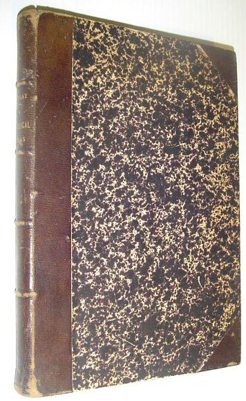
London: William Tegg & Co., 1854. Book. Good. Hardcover. Reprint. 8vo - over 7¾" - 9¾" tall. "Comprised in twenty-six maps showing the various divisions o… More...
London: William Tegg & Co., 1854. Book. Good. Hardcover. Reprint. 8vo - over 7¾" - 9¾" tall. "Comprised in twenty-six maps showing the various divisions of the world as known to the ancients composed from the most authentic sources with an index of the ancient and modern names." - from title page. Includes the following maps: Orbis Veteribus Notus; Roma; Italia Meridionalis; Athenae; Peloponnesus et Attica; Graecia Septentrionalis; Insuleae Maris Aeg Aei; Macedonia, Thracia, Illyria, Moesia, et Dacia; Britannia; Insuleae Britannicae; Gallia; Germania; Vindelicia, Noricum, Rhaetia, Pannonia, et Illyricum; Hispania; Africa Septentrionalis; Aegyptus; Asia Minor; Palaestina; Syria; Armenia, Mesopotamia, Assyria, et Babylonia; Arabia; Imperium Persicum; Indiae. Fold-out map entitled 'Central Italy with the Adjacent Countries from the Peutingerian Tables, constructed about A.D. 393'. Extensive 44-page index of place names. Hand done colour outlines to most maps. Average external wear. 1.5" opening to upper corner of front free endpaper. Toning to endpapers. Gilt titling clearly legible upon backstrip. Binding sound. A quality copy of this wonderful reference.., William Tegg & Co., 1854, 2.5<
Shipping costs: EUR 20.91 RareNonFiction.com